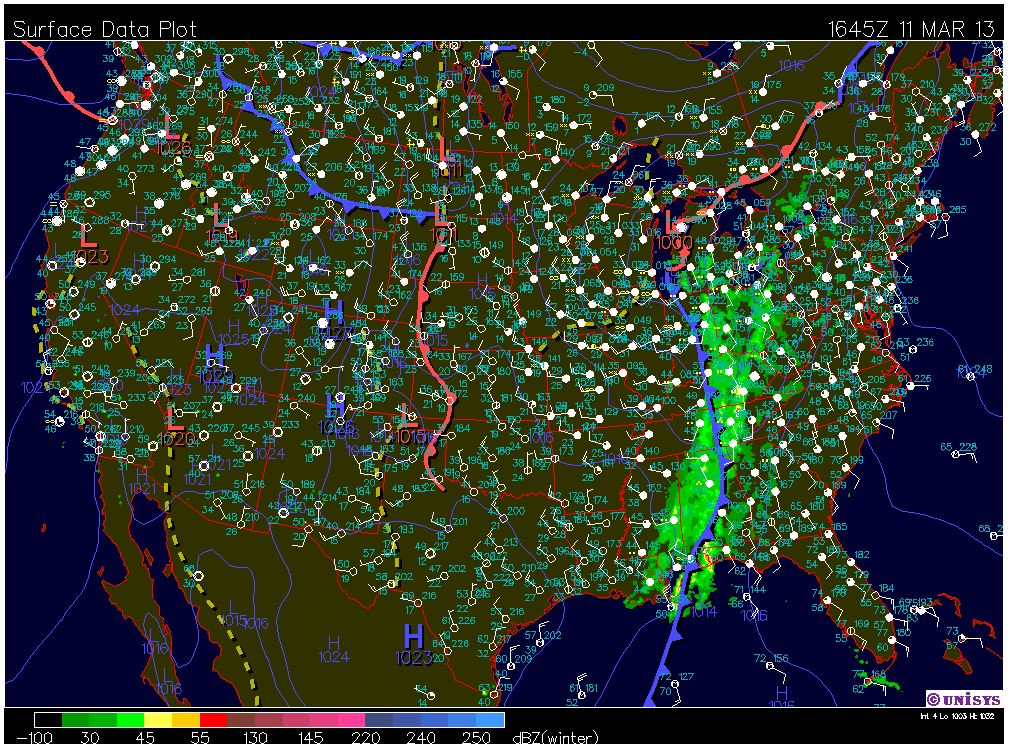
Well I was wrong about saying that the storm moving in over the weekend wasn't going to be too bad. We were in a winter storm from Saturday till noon today. After today's snowfall the Eau Claire area is expected to have a total of 8 inches of snow accumulation. With that 8 inches added to the snow accumulation we had the previous week there is a total of 14 inches on the ground. We can see from the surface map below that the low pressure system has moved over Michigan at this point. We can also see the cold and warm front associated with this systems, and the resulting precipitation in the form of rain ahead of the cold front. We are still experiencing bits of precipitation in the form of snow in our region. Looking at the wind surface data map and the wind map below we can see that this is probably due to the NE winds that are pulling warm, moist air over lake superior and into Wisconsin where it's running into cool, dry air.


Today's high was 32F at 1:05pm, with overcast cloud cover.
Tonight's forecast calls for a low of 19F with overcast cloud cover. Winds will be coming from the W around 5-10 mph.
Tomorrow's forecast calls for a high of 30F, with winds coming from the NW around 10-15 mph. There is 60% chance of precipitation in the form of snow, with an accumulation of less than 1 inch.
No comments:
Post a Comment