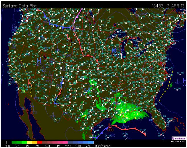
By comparing the surface and jet stream map to yesterday's surface and jet stream map we can see that the high pressure system that was located in eastern North Dakota has moved over Wisconsin. This is due to two influences. First, we have the jet stream pushing in this direction. Second, there was a low pressure system located over South Carolina. As we know areas of high pressure move to areas of low pressure. So the high pressure system located over us has shifted SE due to the jet stream and low pressure system on the east coast.


This morning got off to a chilly start with temperatures in the teens, but temperatures are rising with current weather conditions are sitting at 29F. The nice warming trend we will be experiencing throughout the day is due to the clear sky conditions from the high pressure system allowing sunshine to beat through and also from winds that are coming in from the S. South winds bring in warm temperature due to the them being warm from the Gulf. Winds are coming in around 5-10 mph. Humidity is currently at 54%, with a dew point of 14F.

Tonight's low is expected to reach 34F. Winds will continue to come in from the S around 15 mph. There is also a 30% chance of precipitation throughout the night hours.
As the front continues to push through tomorrow there is a chance for light showers in the am hours. Tomorrow's high is forecasted to reach a high of 46F. Winds will be shifting and will be coming in from the NW.
No comments:
Post a Comment